MOOSEHEAD LAKE (Day 3 - part 1)
The weather forecast called for rain today but fortunately we were able to reschedule a few things. After a wonderful self-serve breakfast, we headed out.
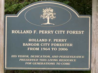
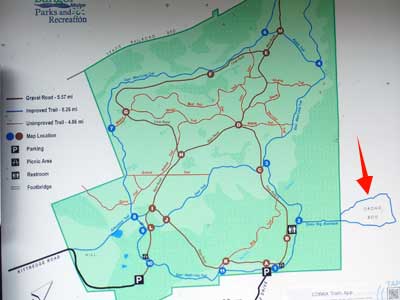
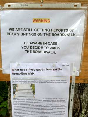
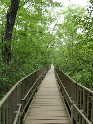
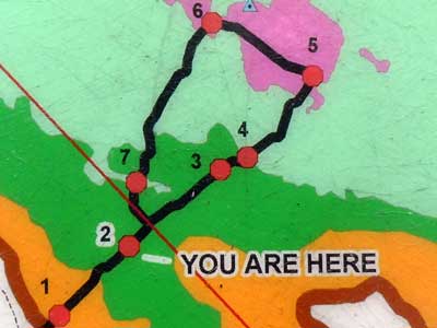
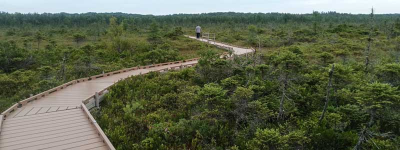
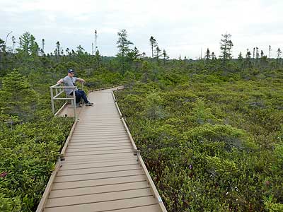
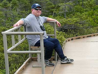
Our first stop was the Orono Bog boardwalk nearby. We drove to the Rolland Perry City Forest and parked. While the bog was technically located outside of the park, this is where the trail began.
Covering 616 acres, the bog is a wetland. Wetland soils are completely saturated with water and only special plants can grow here. This bog is also special because it rests on a deep layer of peat. Peat is made up of the remains of mosses, leaves, seeds, branches and trees. During the early stages of decay, oxygen is used up faster than it can travel through the water-saturated soil. This prevents the matter from decomposing. Over time, this builds up, created peat. This peatland has acidic and infertile soil, resulting in dwarfed plant growth.
History of the basin: About 15,900 years ago, the glacier which covered this area melted away. The sea flooded in. After several hundreds of years, layers of silt and clay built up, resulting in land which rose out of the sea and created a large basin. Around 11,200, the climate became wetter and the poorly drained silt-clay soil became waterlogged. Thousands of generations of wetland plants have added their remains to the peat, which is now as deep as 25 feet in some parts of the bog.
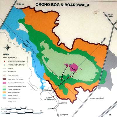
Blue - peatland modified by beavers
Orange - mixed forest
Green - conifer woods
Light green - wooded shrub heath
Pink - moss lawns
The numbers are the locations of informative signs.
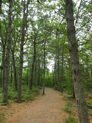
We set out to walk the bog loop trail. It started through dry forest...
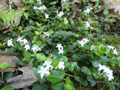
Partridge berry
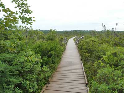
... and quickly we arrived at the elevated boardwalk.
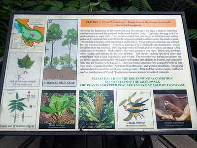
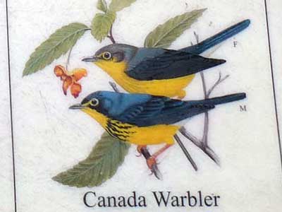
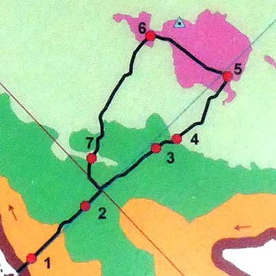
Sign 1 - Broadleaf deciduous forest with scattered evergreens (the orange area) - This area often acts as a shallow moat that carries water around the peatland. Along with red maples and black ash trees are northern white cedars and balsam firs. There are also ferns and skunk cabbage. Certain birds and animals are also specific to the region.
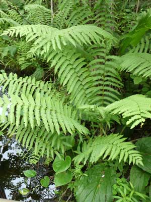
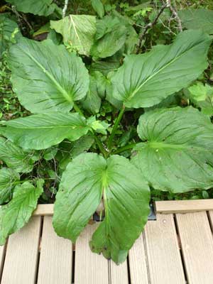
Fern ... skunk cabbage
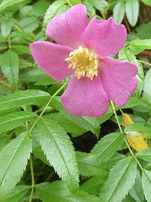
Wild rose
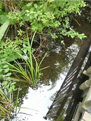
There was plenty of water below us!
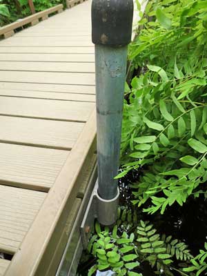
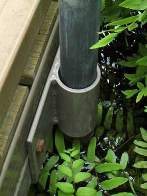
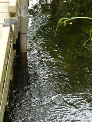
The boardwalk was not anchored in place but instead was very bouncy as we walked. It had the flexibilty to slide along poles to adjust to the constantly changing water level.
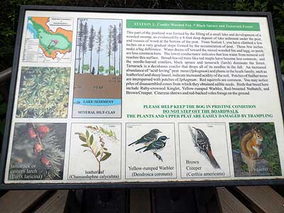
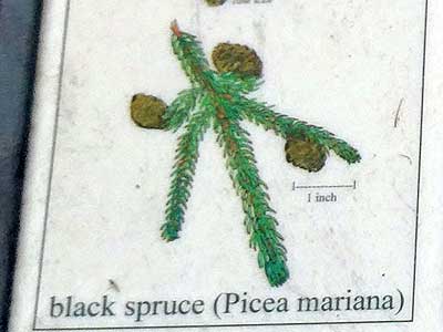
Sign 2 - Conifer wooded fen (green area)- While it was scarcely noticeable, we had apparently ascended a few inches up accumulated peat. But this is enough to make a big difference. Much of the water had drained off, allowing for different plants (and the animals that depend on them). Black spruce and tamarack (or larch, a deciduous conifer that loses its needles in the fall) thrive here. Red squirrels and voles replace the frogs and salamanders of the last area. The increased acidity in the soil is perfect for plants in the heath family, such as sheep laurel.
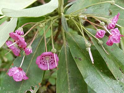
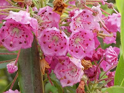
Sheep laurel
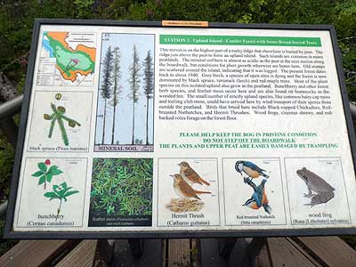
Sign 3 - Upland island (still green) - A raised section just before we left the wooded areas for the peatland. A lot of this area was logged prior to the 1940s.
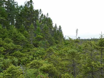
There was an obvious and drastic line where the forest ended.
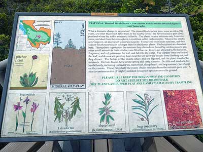
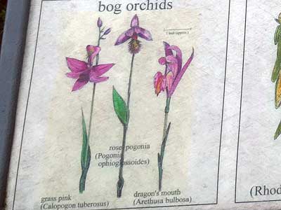
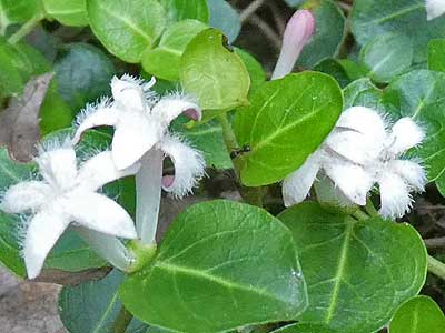
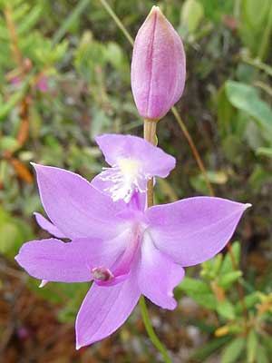
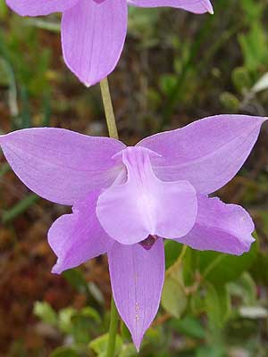
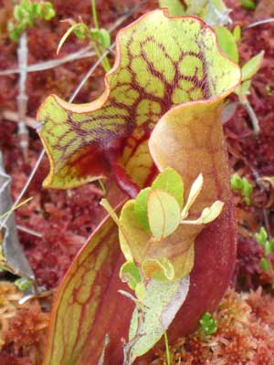
Sign 4 - The wooded shrub heath (light green) - This area is extremely infertile. The stunted trees here are actually older than the big trees we had just walked through. Plants only receive nutrients from the rain, snow and dust from the atmosphere. Most of them are evergreens, giving them a longer season for photosynthesis. Among the amazing plants found here are pitcher plants and orchids.
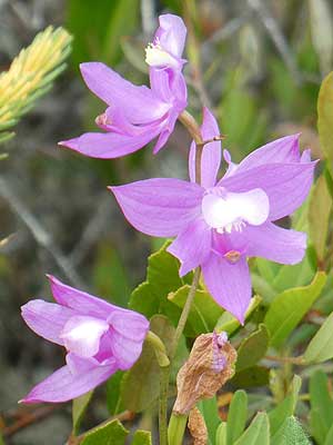
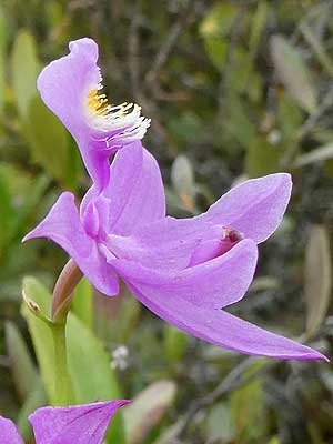
Grass-pink orchid
Orchids have fungi on their roots. This helps the plant obtain whatever nutrition they can from the soil.
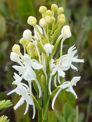
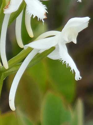
White-fringed bog orchid
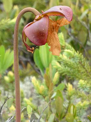
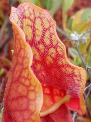
Flowers from the pitcher plant
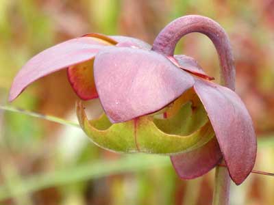
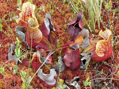
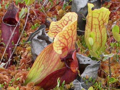
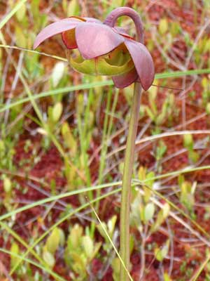
Pitcher plants catch insects and other small animals in their tubular, rain-filled leaves. A slippery inner surface and downward pointed hairs prevent them from escaping. After they drown, their bodies decay and are digested by the plant.
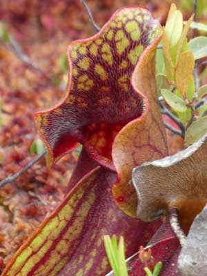
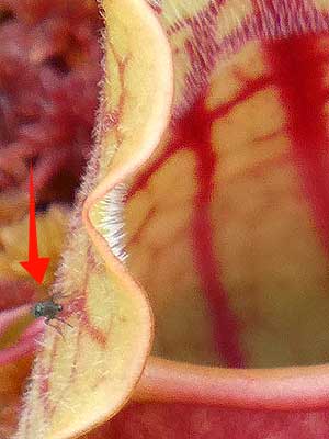
(right) A possible next victim!
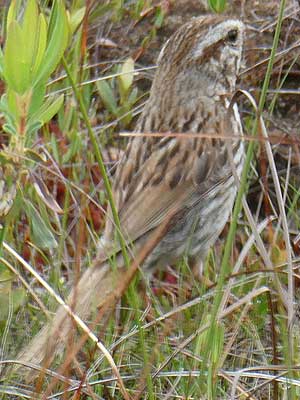
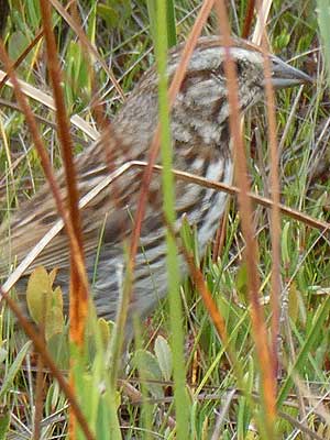
A song sparrow darted quickly among the foliage.
return • continue

