SCENIC FLIGHT (Day 5 - part 1)
We hit the road around 8:30 am, after enjoying our lovely free breakfast.

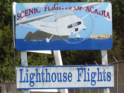
There was lots of traffic heading into Bar Harbor and things were starting to back up. Fortunately we got to avoid the long lines since our destination was Trenton, the town before crossing over the bridge onto Mount Desert Island. I had booked us a flight on a Cessna 172 with Scenic Flights of Acadia. We were doing the Historic Penobscot Bay Lighthouse Tour, which included flying over 12 lighthouses!

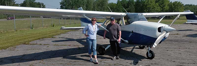
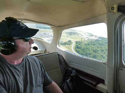
Silas was our pilot. He had taken his first flight lesson at the age of 10 and got his pilot's license at 17 in 2020. Sean climbed in back while I got the front passenger seat.
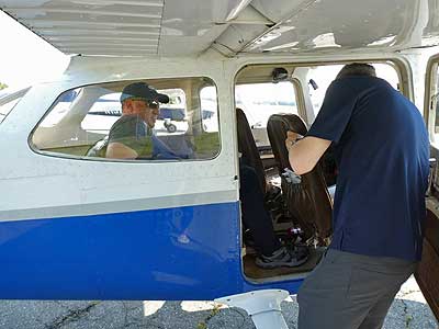

Climbing in .... our flight mascot!
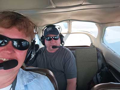
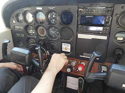
Ready to go! ... Starting the engine
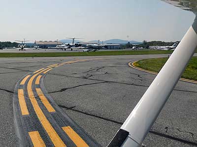
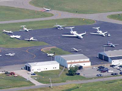
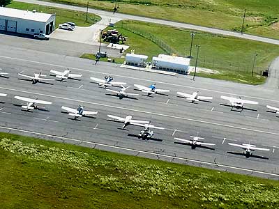
Taxiing past the other planes
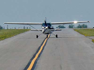
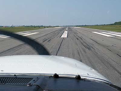
Sharing the taxiway ... Taking off
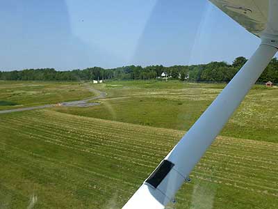
The airport below us
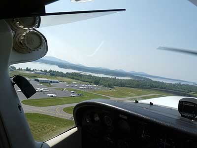
The Hancock County–Bar Harbor Airport was built in 1934. Originally it was just a grass strip. It became the Bar Harbor Naval Auxiliary Air Facility during World War II, supporting naval operations (such as looking for submarines off the coast) and training pilots. After the war, the U.S. government returned the airport to the town, and in 1962, ownership was transferred to Hancock County.
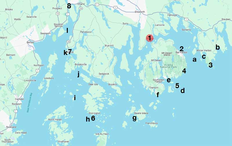
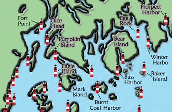
Our flight plan. The numbers are sights and the letters are lighthouses.
(1) airport, (2) Bar Harbor, (a) Egg Rock, (b) Prospect Harbor, (3) Rockefeller Hall, (c) Winter Harbor, (4) Sand Beach,
(5) The Station, (d) Baker Island, (e) Bear Island, (f) Bass Harbor, (g) Burnt Coat Harbor, (6) quarry,
(h) Deer Island Thorofare or Mark Island, (i) Eagle Island, (j) Pumpkin Island, (7) Castine, (k) Dice Head, (l) Fort Point, (8) Fort Knox
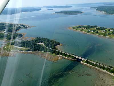
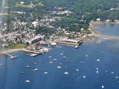
Bar Harbor Road going over the Mt. Desert Narrows and Thompson Island to Mt. Desert Island ... Rounding Leland Point
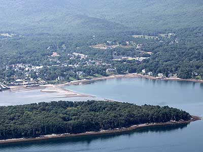
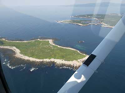
Bar Island, the town of Bar Harbor, and the Bar Island land bridge (which is only visible during low tide)
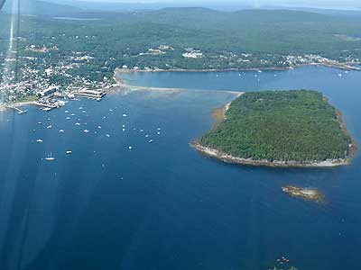
The John B. Ells Pier ... Sheep Porcupine Island and Bar Island
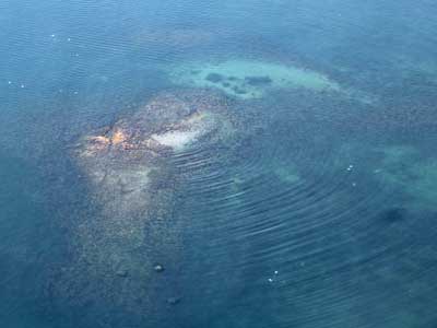
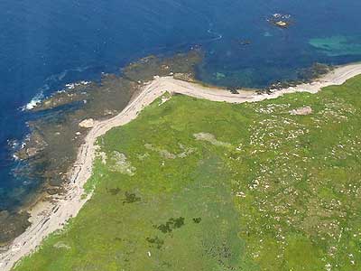
Porcupine dry ledge extending from Bald Porcupine Island
We arrived at our first lighthouse...

I found lots of the following information at this great website. I've just provided brief summaries but some of the history and stories are amazing! If you wish to learn more, I have each lighthouse linked to the appropriate page.
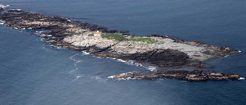
Egg Rock (also once known as Gull Island) got its name for the bounty of nesting seabird eggs that could be collected there. Once the lighthouse was built in 1875, the birds left. Since 1998, the island has been a protected bird sanctuary. A lighthouse was needed here due to the increase in seasonal ferry traffic and fog was often a problem (the foghorn was operated for 348 hours in the month of July 1906 alone). A few months after being activated, a huge storm washed over the rock... smashing some windows, flooding the keeper's house, carrying away the fuel shed and dragging the bell tower some 30 feet. Subsequent storms in 1887, 1900 and 1908 swept away more things (such as the outhouse) and even moved rocks weighing up to 30 tons. It was automated in 1976 and converted to solar power in 1999.
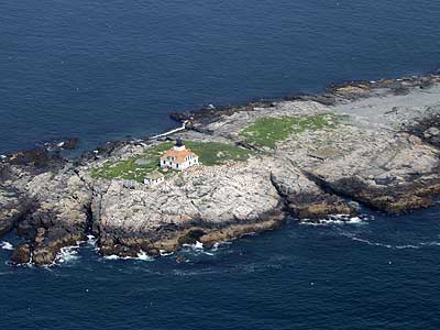

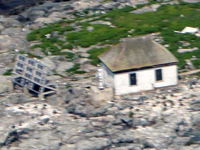
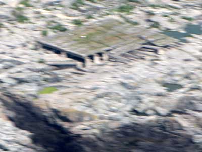
Side buildings and old foundations
Our next lighthouse was the Prospect Harbor Light. So we flew north towards the town of Winter Harbor then east.
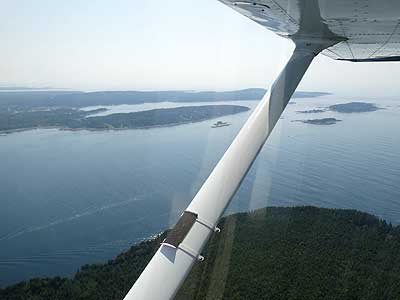
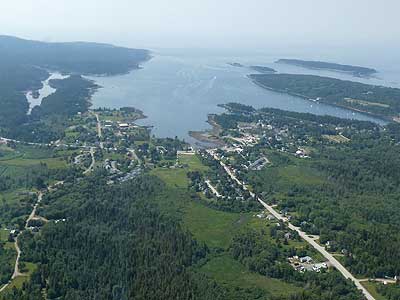
Flying over Ironbound Island with views of the Grindstone Neck peninsula and the bays of Winter Harbor ... Passing north of Winter Harbor

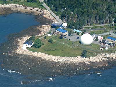
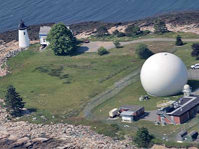
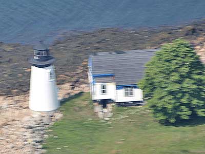
Built in 1849, the Prospect Harbor lighthouse was discontinued in 1859 after it was decided that the harbor did not justify the cost of its maintenance, but it was re-established a decade later. The old structures began being rebuilt in 1891. The light was automated in 1934. It currently stands on the grounds of a US Navy satellite operations station.
We then headed back, going around the Schoodic peninsula to get to the Winter Harbor Light on Mark Island.
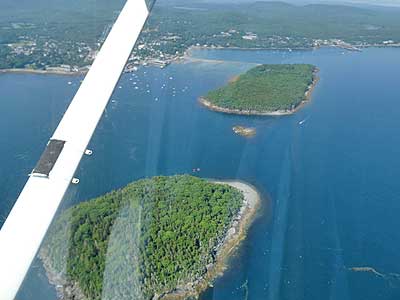
Schoodic Island, with Little Moose and Big Moose Islands at the tip of the peninsula in the background ... Flying over Schoodic Island
Rounding the Moose Islands ... Little Moose Island
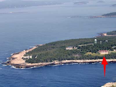
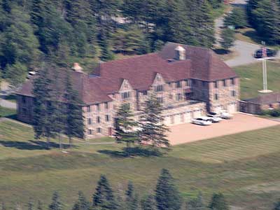
Rockefeller Hall on Big Moose Island
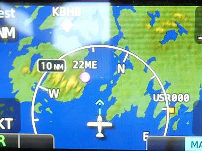
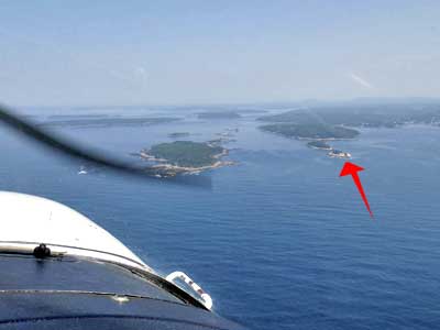
A map on the instrument panel always showed us where we were. ... Approaching Turtle Island (left) and Mark Island (red arrow)
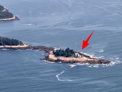
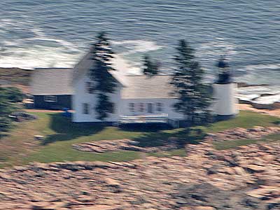
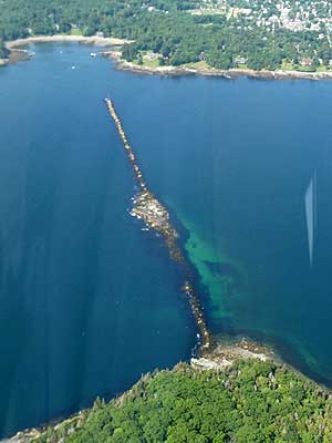
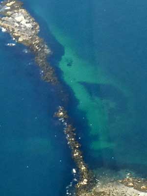
Winter Harbor Light on Mark Island, connected to Ned Island
The Winter Harbor Lighthouse is also known as Mark Island Lighthouse. It was built in 1857 to guide ships away from nearby treacherous ledges. In 1933, however, its service as a navigational guide ended, having been replaced by a lighted bell buoy. In 1934, it was announced that nine Maine lighthouses were being sold. This was one of them. It was auctioned off for a mere $552. It passed through the hands of many owners over the decades and was often abandoned and left to fall into disrepair. A light was finally returned to the repaired tower in 1996. It had to be orange, however, to indicate that it was private and not an official US Coast Guard light. It was sold again in 2004.
return • continue

