SCENIC FLIGHT (Day 5 - part 2)
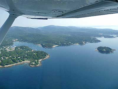
On our flight to Baker Island Light, we passed several familiar landmarks as well as a few new ones.
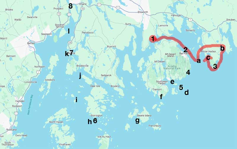
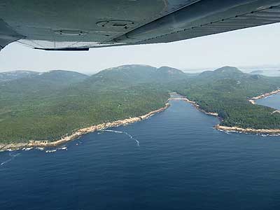
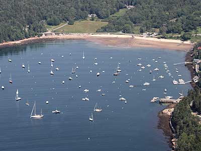
Our route so far
(1) airport, (2) Bar Harbor, (a) Egg Rock, (b) Prospect Harbor, (3) Rockefeller Hall, (c) Winter Harbor, (4) Sand Beach,
(5) The Station, (d) Baker Island, (e) Bear Island, (f) Bass Harbor, (g) Burnt Coat Harbor, (6) quarry,
(h) Deer Island Thorofare or Mark Island, (i) Eagle Island, (j) Pumpkin Island, (7) Castine, (k) Dice Head, (l) Fort Point, (8) Fort Knox
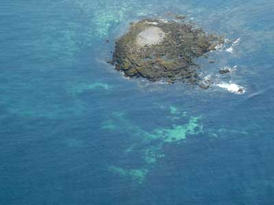
Another view of Egg Rock Island and its lighthouse
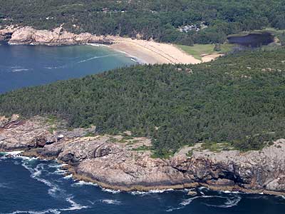

Sand Beach, behind Great Head peninsula. Composed of shell fragments, it is one of the few sandy beaches in the area.
Great Head, Old Soaker Island, Newport Cove and Sand Beach
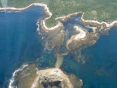
Otter Point and Otter Cove
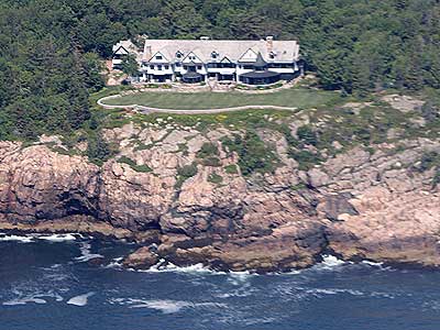

Dick Wolf's house (producer of Law and Order tv show) ... Little Hunters Beach
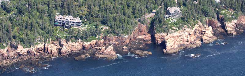
Rhodes Cliff
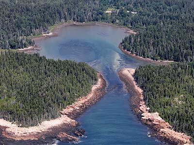
Seal Harbor
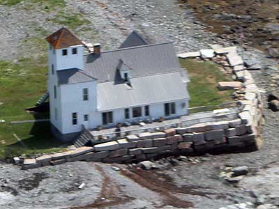
The Station
Built in 1880, this was once the US Coast Guard Life Saving Station on Little Cranberry Island. Watchmen would for ships in distress then take lifeboats out to save them. It has been decommissioned and privately owned since 1946.
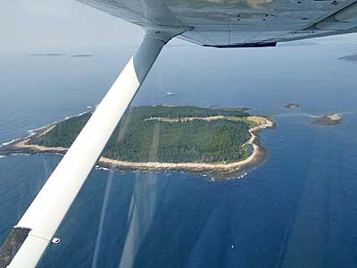
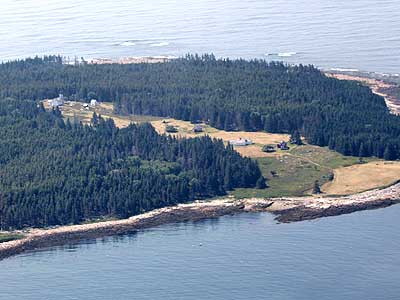
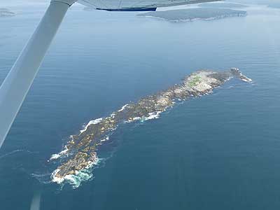
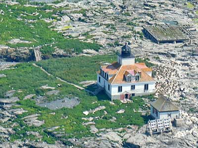
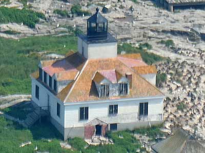
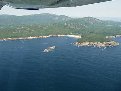
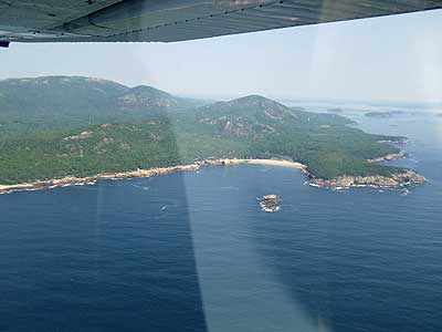
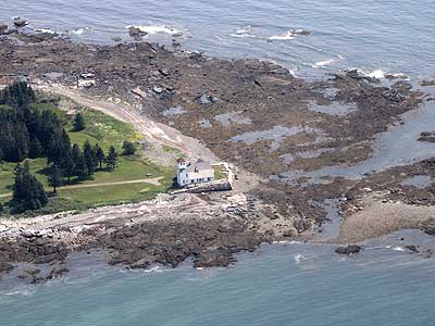
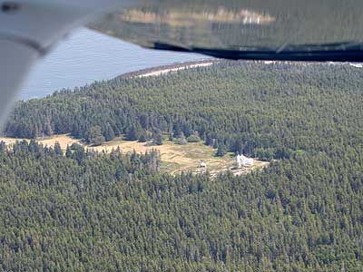
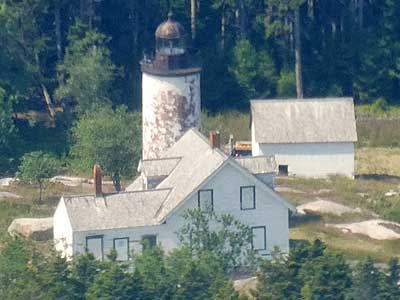
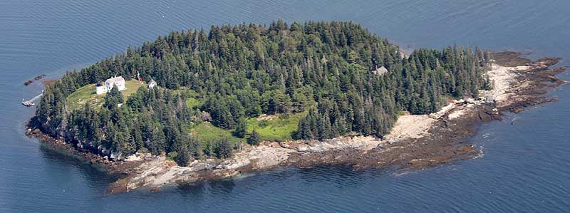
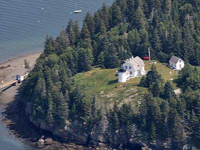
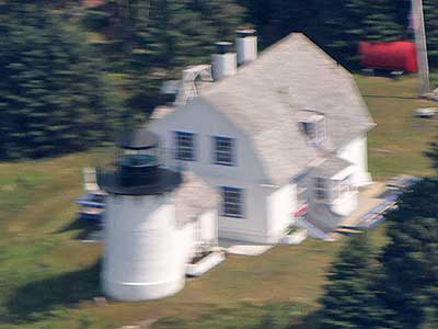
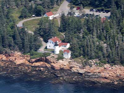
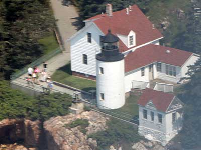
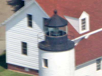
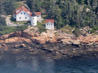
Baker Island
Baker Island is the outermost of the five Cranberry Isles, named for the bright red berries found there in the fall. In 1812, the Gilley family moved to this rocky, unclaimed and unoccupied island. They cleared the land, built a home and eventually had 12 kids. When the government built a lighthouse on the island in 1828, Mr. Gilley became logical choice as its first keeper. It was a tough life but there was usually plenty of food, including the pigs, sheep, ducks, chickens, and cows they raised. There was also plenty of lobster and fish. However, there was little heat, no fresh water well, and no government boat. The dwellings were also in serious states of decay. Eventually things turned around in 1853 with restorations and upgrades for the future keepers. Most of the island was transferred to the National Park Service in 1958. The lighthouse remained in possession of the Coast Guard until 2011, when it also became part of the Park Service.
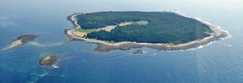
Baker Island

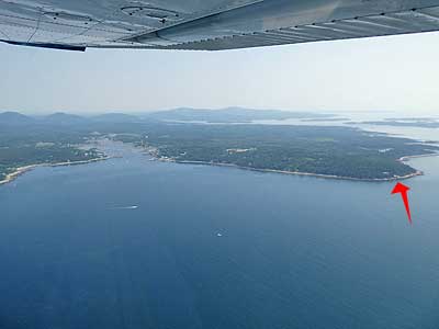
(right) Flying back over The Station (at the tip of the peninsula)
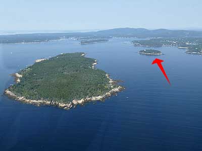
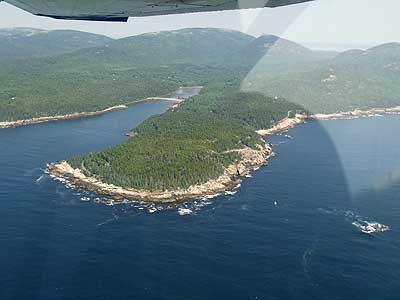
Sutton Island and Bear Island (red arrow) ... Flying over Sutton Island
Bear Island might have originally been named Bare Island due to a lack of trees. It is one of the Cranberry Isles. The lighthouse was built in 1839, serving the entrances of Northeast and Southwest harbors. The lighthouse was severely damaged by a fire in 1852 but rebuilt the following year. There was even an aerial tramway that could haul supplies from the wharf to the top of the island. After 1981, the deteriorated light was deactivated and replaced by two lighted bell buoys anchored offshore. It became owned by the National Park Service in 1987.
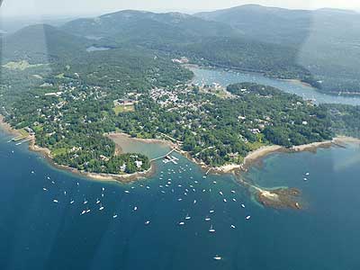
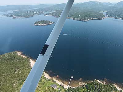
The town of Northwest Harbor
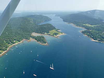
Somes Sound ... Norwood Cove
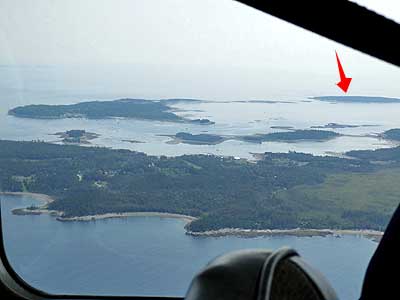
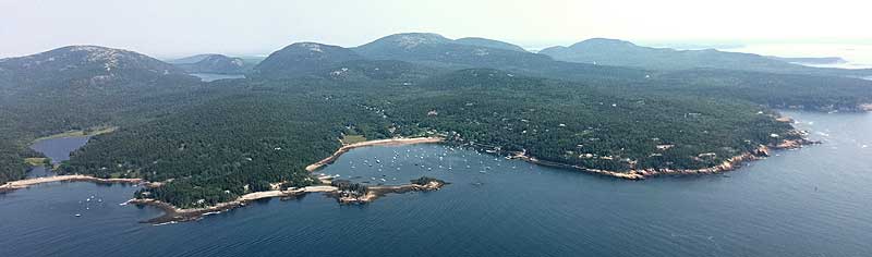
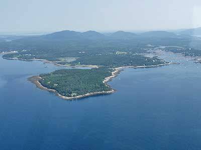
Great Cranberry Island, Little Cranberry Island and Baker Island (red arrow)
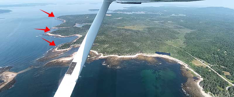
Bennet Cove with Wonderland Trail (front arrow), Ship Harbor (middle) and Bass Harbor Head (farthest arrow)
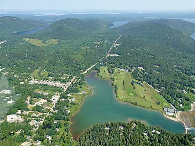
Bennet Cove and Long Ledge ... Ship Harbor
A familiar sight from yesterday! Bass Harbor is the only lighthouse actually on Mount Desert Island itself. It was constructed in 1858. The tower is only 32 feet high but its light is 56 feet above sea level thanks to the granite cliff on which it stands. Its red light is visible for 13 nautical miles. The longest-serving keeper here was Willis Dolliver, who was in charge from 1894 until 1921. He was 70 years old when he retired. The lighthouse was automated in 1974. In 2020, it became part of Acadia National Park.
Bass Harbor lighthouse (red arrow) ... Lopaus Point
We then banked and headed southwest towards Burnt Coat Harbor Lighthouse.

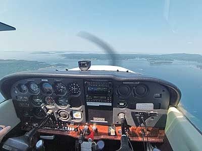
The instrument panel
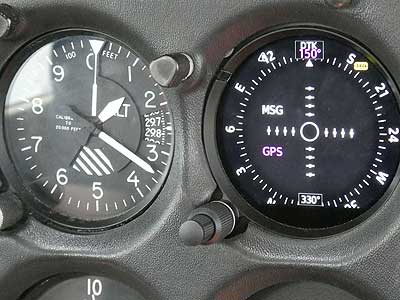

Elevation ... direction
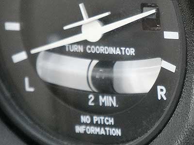

Banking
return • continue

