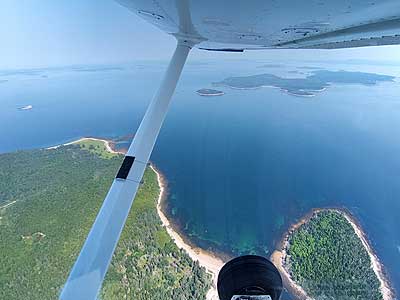
SCENIC FLIGHT (Day 5 - part 3)
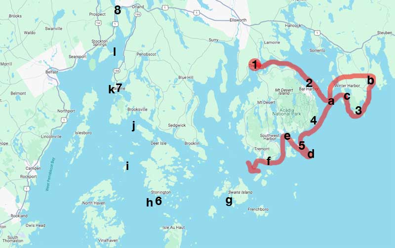
Our complete route so far
(1) airport, (2) Bar Harbor, (a) Egg Rock, (b) Prospect Harbor, (3) Rockefeller Hall, (c) Winter Harbor, (4) Sand Beach,
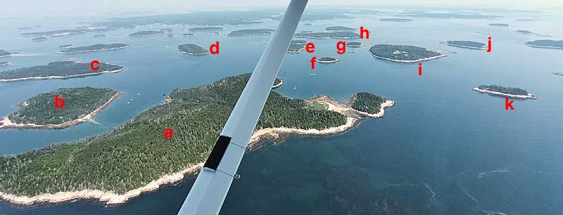
(5) The Station, (d) Baker Island, (e) Bear Island, (f) Bass Harbor, (g) Burnt Coat Harbor, (6) quarry,
(h) Deer Island Thorofare or Mark Island, (i) Eagle Island, (j) Pumpkin Island, (7) Castine, (k) Dice Head, (l) Fort Point, (8) Fort Knox
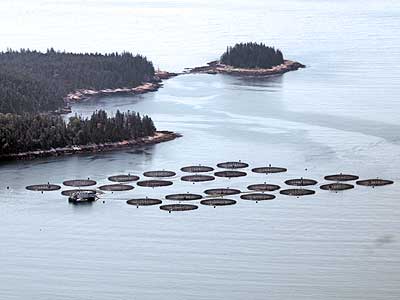
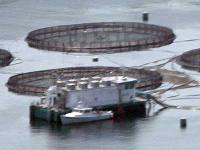
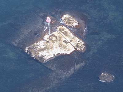
Salmon ponds for commercially raising fish
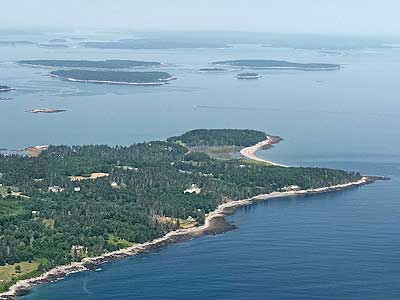
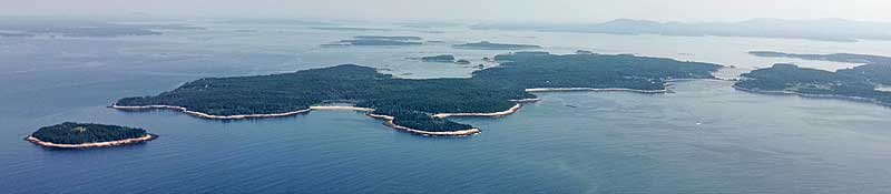
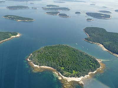
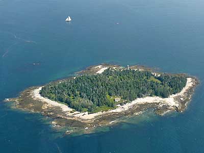
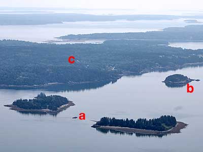
Swans Island ... Burnt Point (closer) and North Point
Flying over Swans Island ... Goose Pond and the town of Minturn
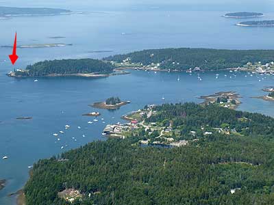
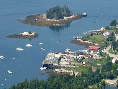
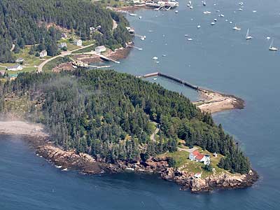
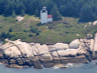
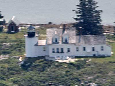
Burnt Coat Harbor Lighthouse (red arrow) ... Minturn, Johnstons Island and Dog Island (small)
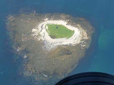
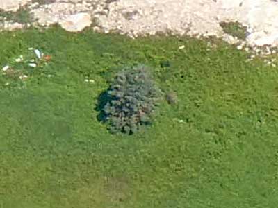
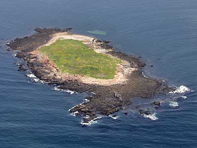
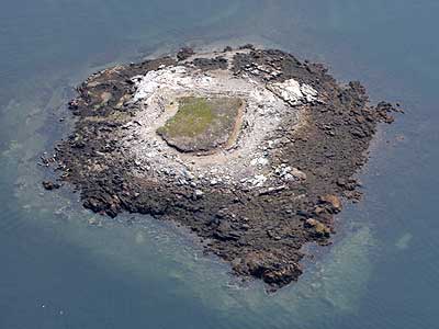
Dog Island ... with its one single tree
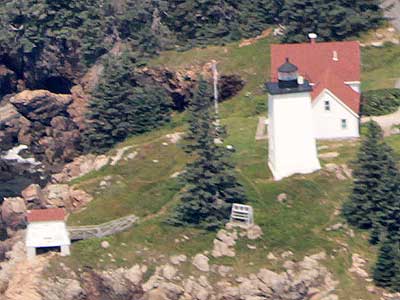
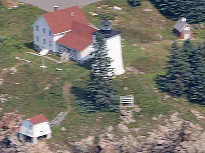
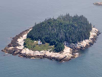
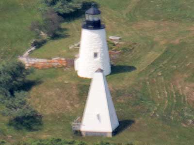
The Burnt Coat Harbor Lighthouse on Swans Island was first lit in 1872. These early lights used whale oil or lard oil (which had a tendency to congeal in the cold winter weather). Fortunately, kerosene became the standard in 1877. The light was automated in 1975. In 1994, it was transferred from the Coast Guard to the local town government. It required a great amount of restoration which began in 2006.
The origin of the island's name is still unclear. Some say it comes from a Revolutionary War soldier who burned his coat as a signal or sign of rebellion. Others day it comes from Samuel de Champlain, who called the area Brule-Cote (or Burnt Coast), presumably because of the numerous fires by Native Americans.
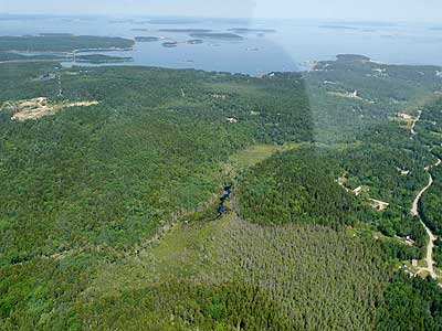
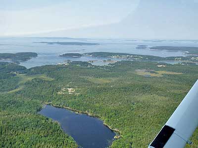
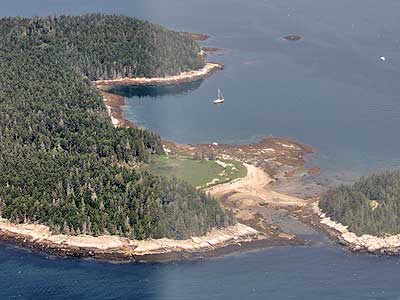
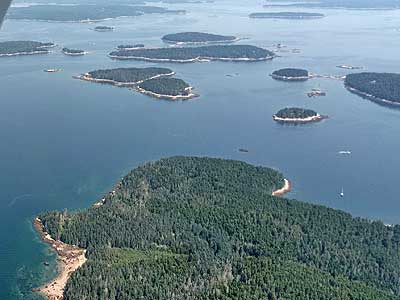
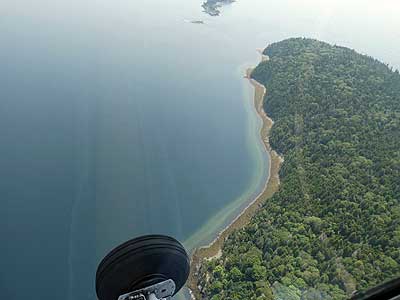
On our way to Deer Island Thorofare, we flew over a whole mess of islands!
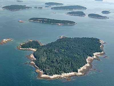
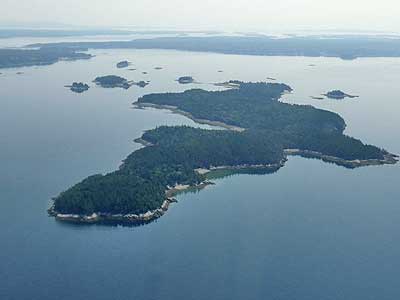
Gooseberry Island (there are several islands with this name) ... Flying over Marshall Island, looking back at Swan Island
Hat Island and Swan Island (including Irish Point)
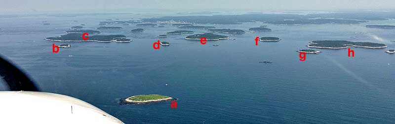
(a) Southern Mark Island, (b) Gooseberry Island (a different one), (c) McGlathery Island, (d) No Mans Island, (e) Spruce Island, (f) Millet Island, (g) Enchanted Island, (h) Saddleback Island
(left to right) Enchanted Island, Saddleback Island, Phoebe Island and Shingle Island

(left) Colby Ledge, with a warning sign. It would be easy to hit an outcropping that small.
(a) McGlathery Island, (b) Round Island, (c) Wreck Island, (d) Bare Island, (e) Coombs Islands, (f) Ram Island, (g) Buckle Island, (h) Devil Island, (i) Spruce Island, (j) Millet Island, (k) No Mans Island
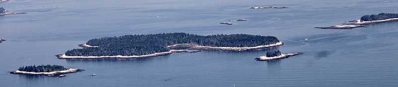
McGlathery Island ... Flying over McGlathery Island, looking towards Coombs Islands and Devil Island
Round Island ... Wreck Island
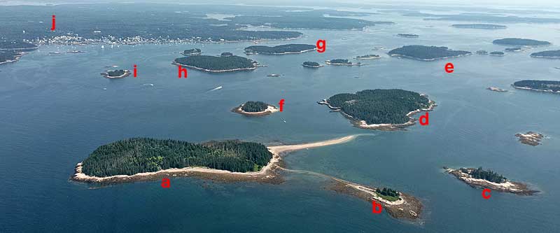
(a) George Head Island,(b) Little George Head Island, (c) Steve Island, (d) St. Helena Island, (e) Camp Island, (f) Potato Island, (g) Russ Island, (h) Green Island, (i) Scott Island, (j) the town of Stonington
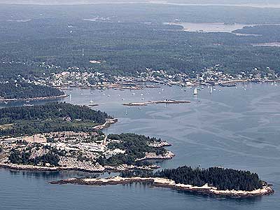
The large quarry on Thurlow Head (Crotch Island) has been operational since around 1860 and still active today. It produces Deer Isle granite, which is used for high-quality building projects and decorative items. ... Farrel Island
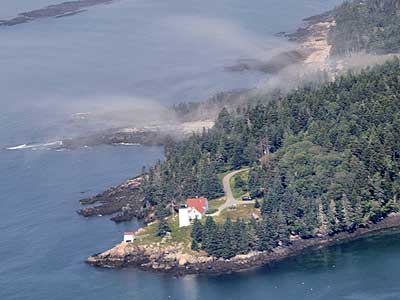
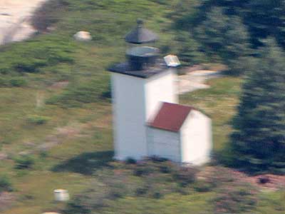
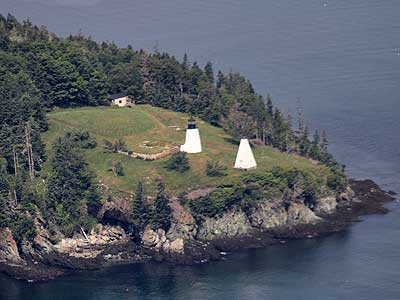
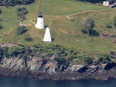
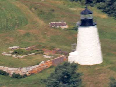
The Deer Island Thorofare is a narrow passage that runs between Deer Isle and numerous islands and ledges. In 1856, a plot of land on Mark Island was purchased from the Thurlow family so a lighthouse could be built. The lens was placed in the tower in 1858 and can be seen from up to 12 miles away. In 1958, a battery charger in the basement exploded, causing the keeper's house to burn down, but the light tower survived. Since traffic in the area had decreased, the Coast Guard decided to automate the station rather than rebuild the dwelling. In 1997, it (along with 34 other lighthouses) was transferred to a trust.
We turned north, towards the Eagle Island lighthouse. There are actually eight different Eagle Islands along the Maine coast.

The Eagle Island Light, completed in 1838, was needed to guide ships going to and from Bangor, which was a busy lumber port. In 1857, a larger, fourth-order Fresnel lens was installed. Shining from 106 feet above sea level, it was visible for 16.5 miles. Keepers had to row about two miles to Deer Isle to get supplies, and upon returning, the supplies had to be hauled up a steep and narrow trail. In 1894, a stairway of 76 steps was built to make things a bit easier. Keepers also had to buy their own uniforms and food for their families, all on a meager salary.
In 1963, the Coast Guard decided to burn down all buildings other than the lighthouse and bell tower because of an increase of vandalism at other abandoned stations. While attempting to remove the fog bell, it slipped and fell off the cliff into the water. They just left it. Years later, a local fisherman noticed it sitting in the deep water and managed to retrieve it.
The lighthouse was among those transferred into a trust in 2000 and saved.
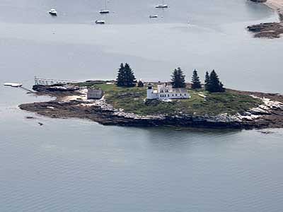
Lighthouse and fog bell ... Ruins of the keeper's house
We continued making our way up to the Pumpkin Island lighthouse.
Flying over Bradbury Island with the tip of Crow Island in the background ... Pickering Island
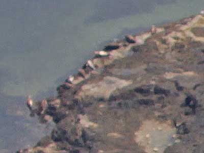
Seals sun themselves on the shore of tiny Two Bush Island (upper left edge of the island)

(a) Scott Islands, (b) Sheep Island, (c) Little Deer Island ... Pumpkin Island
Pumpkin Island is less than two acres in size. The lighthouse was first lit in 1855 and decommissioned in 1933. It was among those sold by the government into private hands. It was purchased by the same man who bought the Winter Harbor Lighthouse. It has been sold several times since then.
return • continue

